Basalt flows dating back millions of years spread far and wide; iconic Pacific Northwest rivers shifted course, trading channels; massive floods shaped the landscape for thousands of years, Wallula Gap’s past is a convergence—of geologic events, of rivers, of civilization.
Today, a convergence of industry builds upriver; waterways continue to provide passage as they have for millennia from the Inland Northwest to the ocean, not only for salmon but now for wheat, soy, wood products, and mineral bulks (Pacific Northwest Waterways Association).
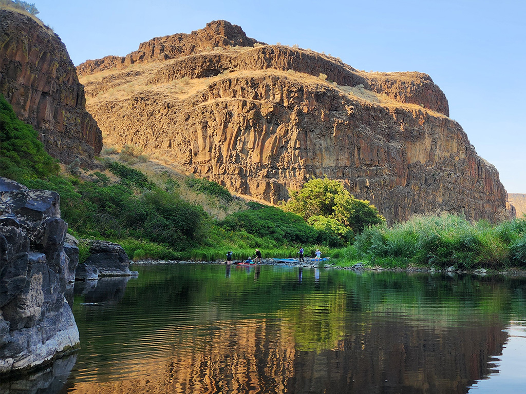
There are so many layers that tell the story of Wallula Gap, and not just in the form of volcanic rock. The Yakima, Snake, and Walla Walla Rivers join the Columbia River within roughly thirty river miles of each respective confluence. “Wallula Gap is the largest, the most spectacular, and the most significant of the several large water gaps through basalt anticlines in the Columbia Basin,” (Wallula Gap National Natural Landmark).
Millions of birds gather here, migrating as far north as the artic. Half the mallards in the Pacific Flyway overwinter at some time in this portion of the Columbia River Basin (McNary National Wildlife Refuge).
In addition to birding, outdoor recreation opportunities include hiking, kayaking, paddleboarding, fishing, horseback riding, and hunting. Layer recreation with natural history, heritage markers, and hopes for its future, and the result is a place that deserves visitation.
As Don Snow, Environmental Studies professor at Whitman College wrote in Where the Great River Bends, “It’s a desert place – shocking to some, inspiring to others – and it is a place worth knowing. Do your homework; go see it; let your imagination do the rest.”
Journey Through Time at Wallula Gap (Video Credit: Strategy Northwest)
Don’t pass by this unique and precious landscape. Outdoor recreation is found amid the wildlife refuge, at historic sites, and on the banks of the Columbia River. Just as thousands of birds do each year, stopover at Wallula Gap.
Stopover at McNary National Wildlife Refuge
The McNary National Wildlife Refuge extends from the confluence of the Snake and Columbia Rivers past the Washington and Oregon border to the town of Hermiston. Our Outside Walla Walla summary of this area, including an excerpt from local naturalist, birder, biologist extraordinaire, Mike Denny, offers tips and resources that helped us flock to the refuge.
At refuge headquarters, a lovely path, the Quail Trail, leads to an observation bird blind, a truly immersive experience. Sightings in this area are numerous. The Blue Mountain Audubon Society periodically hosts field trips to the refuge. This enthusiastic bunch boasts a stellar life list and wants to help you build yours.
Migration brings waves of species to the Wallula area, nesting in the basalt cliffs or foraging in the wetlands. The refuge is an ever-changing yet cyclical treasure to visit often.
On those repeat visits, a stroll along one of the refuge’s trails not only supports birding but transports visitors to riparian habitat, showcases watershed viewscapes, and offers glimpses of many creatures in their element.
As mentioned, the Quail Trail is located at the McNary National Wildlife Refuge Headquarters and is just under two miles. The Peninsula Connector and Quarry Pond Trails hug the Curlew and Quarry Ponds and help provide access to that particular inlet of Lake Wallula, both clocking in around a quarter mile.
For a longer excursion up the mouth of the Walla Walla River, the Wallula Horse Trail (sometimes referred to as Madame Dorian) extends 4.47 miles through cottonwood and willow trees and past sage brush. The berms weaving throughout also provide wide, walkable areas to wander.
Lastly, the only named trail in the refuge on the Oregon side is Juniper Canyon Trail. Although less than a quarter of a mile, this oasis in the desert is unique. “The vegetation immediately adjacent to water (for example, in Juniper Canyon) differs completely from the rest of the vegetation. Wallula Gap is part of a desert, yet there are beavers. Wallula Gap has no mountains, yet there are bighorn sheep. The bedrock is all basalt, yet there are granitic boulders,” (Where the Great River Bends, page 11).
Many activities fall under the umbrella of recreation. Hunting regulations are specific to the area and refuge, but in general the migratory and upland game seasons typically end by March.
While many pass through this area at highway speeds, distracted by the commerce that now lines the banks of the Columbia River, a simple walk is all that is needed to recognize how vital this habitat is for wildlife and us.
With an eye on the future of this critical habitat, the McNary National Wildlife Refuge in collaboration with the Confederated Tribes of the Umatilla Indian Reservation are working to restore wetlands, riparian corridors, and increase the complexity of the river channel.
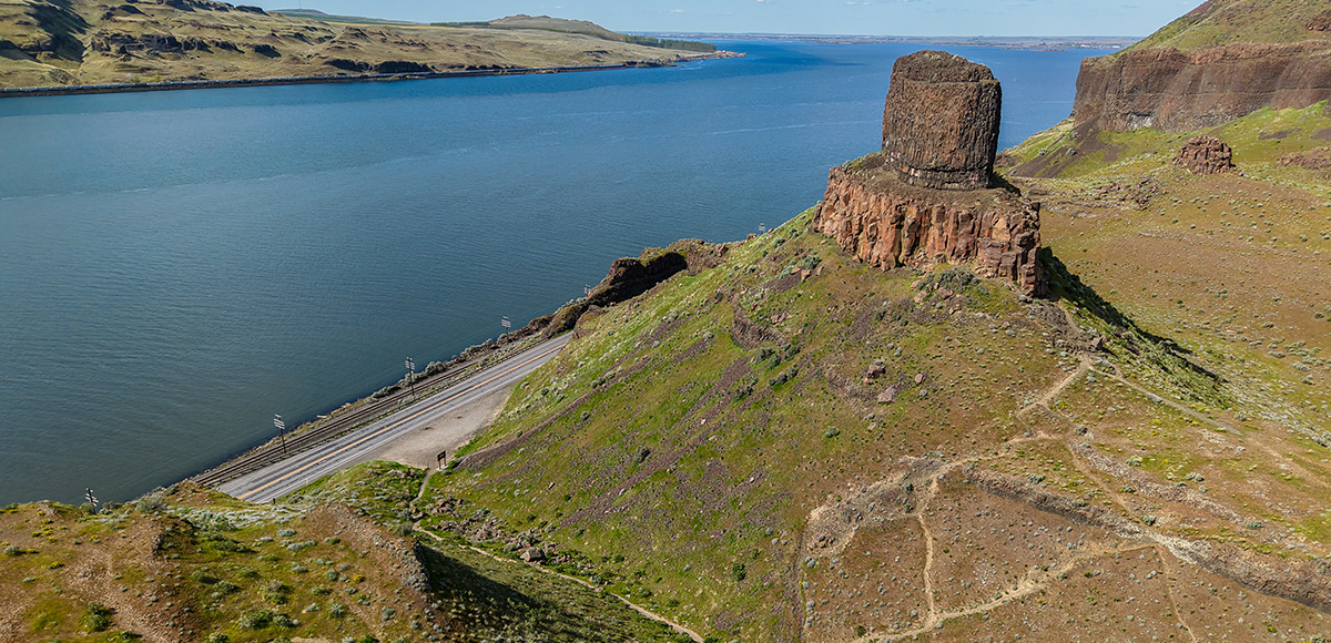
Twin Sisters (Photo Credit: Strategy Northwest)The Columbia River is massive. Lake Wallula is considered the water pooled behind McNary Dam in Umatilla, Oregon just downriver. Views of this waterway from Twin Sisters offers an incredible vantage point. Though the trails are short, the destination is worth time spent enjoying.
As Legend Has It, Hike to History
Noted as Walla Walla County Historic Sites, the Wallula Historic Site and Twin Sisters Monument are within a mile of each other. Short hikes lead to expansive views, and information kiosks recognize the area’s cultural significance. For comprehensive information, please enjoy Walla Walla 2020’s Wallula History research, including hikes near these storied places.
Panoramic vistas just add to the allure of learning more about these sites. Imagine what Wallula Gap looked like a hundred years ago, a million years ago.
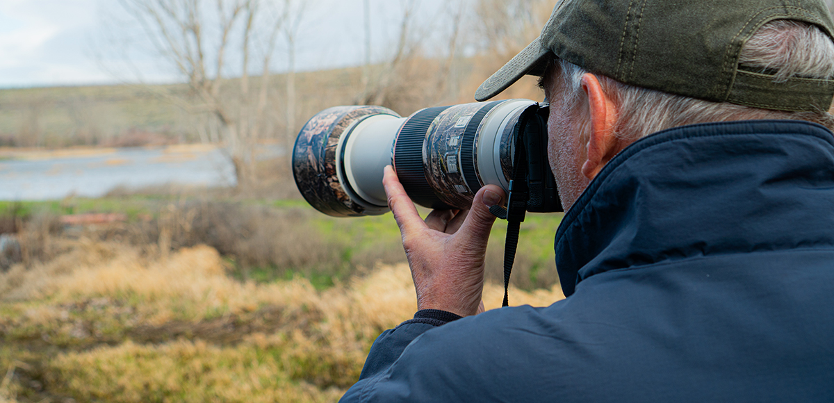
Blue Mountain Audubon Society Field Trip (Photo Credit: Strategy Northwest)This group of enthusiast birders has a gigantic life list, and they kindly share their passion and knowledge through field trips, their website, weekly bird walks, and a handy pocket field checklist to area birds. Follow them on Facebook for updates and sightings.
Many Waters & Many Water Activities | Fish, Kayak, and Paddleboard
The McNary Dam near Umatilla, Oregon pools the Columbia River, forming Lake Wallula. This large body of water supports a variety of water sports, including fishing, kayaking, and paddleboarding.
Some of the fish found in its waters include largemouth bass, smallmouth bass, crappie, yellow perch, catfish, walleye and salmon. Fishing regulations are highly specific and based on species and location, so make sure to consult with the governing agency directly. Quarry Pond is the only pond stocked by the Washington Department of Fish & Wildlife.
To launch your favorite human-powered water craft, consider Columbia River access near Wallula Gap or boat launches within the McNary National Wildlife Refuge, namely the Madame Dorian boat launch on the Walla Walla River. If utilizing a boat launch within the refuge, there are restricted areas, and it is best to consult the map. If you think that exiting the highway changes perspective, you are in for a treat when you leave solid ground.
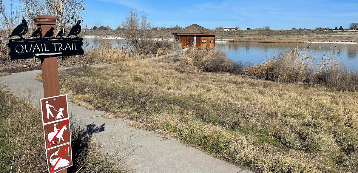
Quail Trail & Observation Bird Blind at the McNary National Wildlife Refuge (Photo Credit: Gwen Dildine)There are so many activities that fall under the umbrella of outdoor recreation. The McNary National Wildlife Refuge supports many activities, including birding, hiking, boating, hunting, and fishing. The history of this region is also worth knowing. Every visit brings a new experience, so visit often.
Schedule Wallula Gap on Your Timeline
Some of the first wildflowers bloom around the gap. Wildlife descends from the sky. If you were at the gap thousands of years ago, you would be in for a wild ride. This place is exceptional and unusual. It is a timeless place to visit. It is worth knowing.