CURRENT CONDITIONS
52° F

OUTSIDE WALLA WALLA
OUTSIDE WALLA WALLA
Biking Main Street to the Mountains
Local Routes by Local Riders
Since the Outside Walla Walla team is not known as seasoned cyclists, we are grateful for our expert friends who are willing to lend a helping hand. Through collaborations like these, we are working to build a community database of outdoor recreation, offering a little something for everyone.
We’ve narrated a few routes and cataloged them by area of town, introducing the outfitter or local group who designed the ride. Check out this growing collection on our Road Routes and Gravel Roads pages.
Please spend a little time digging into this compilation of information. There is a lot to cover, and we want you to have a great ride. No matter which direction you choose, adventure awaits.
How to Use This Guide
Think of this guide as a hub—a launch point that connects years of local insight, trail mapping, and riding experience. We recommend starting with a single ride and getting familiar with the Ride with GPS app. Once you’ve found your rhythm, keep exploring.
We’ve paired technical maps with narratives that highlight the character of each route, aiming to offer not just information, but inspiration.
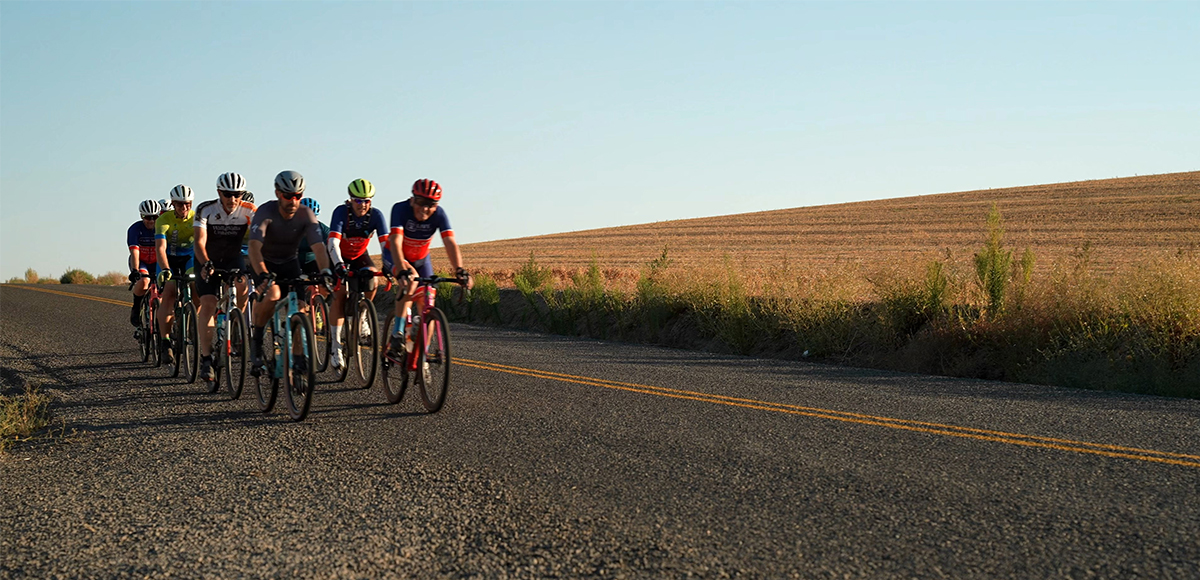
Road Routes Across the Walla Walla Valley
Cycling is one of the region’s most cherished outdoor activities. The roads surrounding Walla Walla are scenic, well-maintained, and easily accessible.
Our Ride with GPS selections are designed by experienced local riders who know these roads better than anyone. Each route out of town has its own charm—from rolling farmland to vineyard-dotted hillsides—so no matter which way you go, you’re in for a beautiful ride.
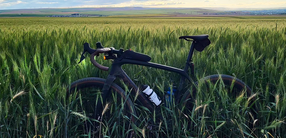
Gravel Riding the Foothills of the Blue Mountains
Gravel riding here is something special. These roads, vital for moving crops like wheat, barley, and chickpeas, double as peaceful cycling routes—especially outside of harvest season.
Best of all, gravel rides are a four-season experience. Ride under a headlamp in winter or cruise in the cool summer morning air. Whether you’re a seasoned gravel grinder or just exploring the style, there’s a road less traveled waiting for you.
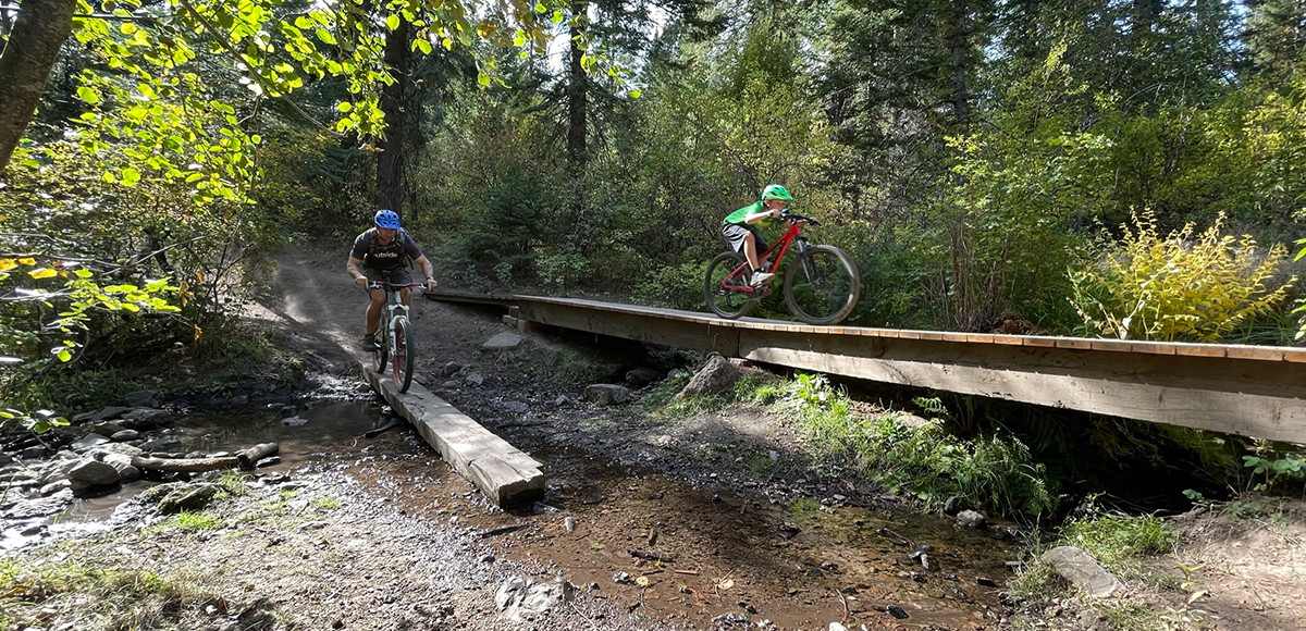
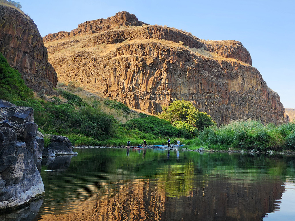
Mountain Biking in the Blue Mountains
Craving forested trails and a bit more challenge? The northern Blue Mountains offer great opportunities for more experienced mountain bikers—with some caveats.
With two Wilderness Areas in our backyard, sometimes navigating which trails allow for what activities can get tricky. You are in luck–we are constantly studying the maps and hopping on our bikes to give you more places to explore the Blue Mountains.
Please note that many trails in the Blue Mountains are quite challenging to ride. The South Fork Walla Walla Trail is still impassable due to a flood that washed out a significant section of the lower trail. That trail connected to several other multi-use trails.
To shuttle a through-ride, the South Fork Walla Walla Trail is necessary. At this point, the closure of the South Fork Walla Walla Trail makes biking that drainage extremely difficult. Otherwise, prepare for a hefty climb back out.
The Umatilla Rim Trail and Mount Emily Recreation Area are not impacted by the South Fork Walla Walla Trail closure. Additionally, Bennington Lake offers single-track trails and is conveniently located in town, near Walla Walla Community College on the east side of town.
Soon, Bluewood (our fantastic ski hill) will offer summer access and mountain biking trails. Stay tuned!
Bike Shops, Events & Resources
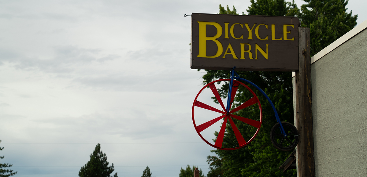
Whether you’re new to riding or have years of experience, the Walla Walla biking community is here to help. Bicycle Barn is a locally-owned shop offering bikes, accessories, repairs—and even pickleball gear! Perfect for casual riders and racers alike. Kickstand Tours provides scenic, guided eBike excursions across the valley. No bike? No problem. Service Course LLC was founded by Kaler Marshall, a local expert providing coaching, service & repair, and race-ready knowledge for all types of riders.
Stop in, ask questions, and get rolling. And yes, it’s perfectly normal to wear your spandex around town—recreate as you are!
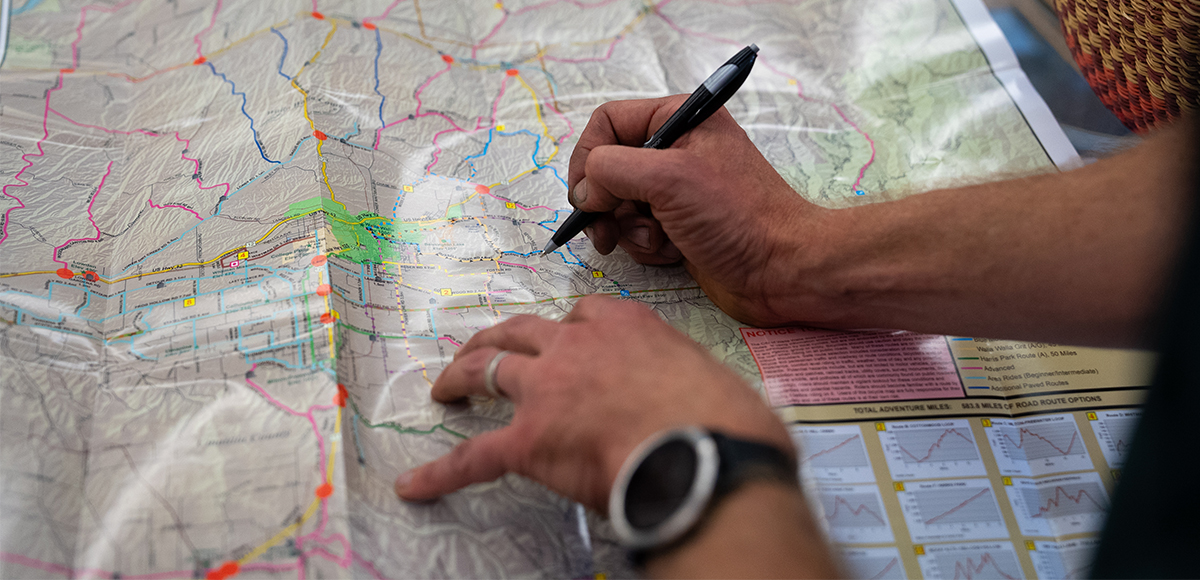
Walla Walla Bicycle Maps
The Bicycle and Pedestrian Advisory Committee of the City of Walla Walla worked with the City of Walla Walla GIS department to publish Walla Walla Bicycle Maps for riders interested in exploring Walla Walla and surrounding area, including parts of northeast Oregon.
We couldn’t have done it better. Seriously, we have no GIS skills, so this is technical. The Walla Walla Bicycle Maps depict approximately 580 miles of road route options and denote the location of bicycle lanes within the City of Walla Walla.
In addition to some fantastic rides, the map also shows riders some points of interest, which turns a lovely day on the bike into a chance to tour some special places in our valley.
Head west to Whitman Mission National Historic Site or go on a grain elevator tour. Head east and ride up to Ski Bluewood or follow Mill Creek to the state line. There are also several surrounding communities that would love to help you fuel up for the ride home. With so many routes available, you just need to keep visiting and keep riding.
Where will the road take you?
Each section in this guide—Road, Gravel, and Mountain—offers a catalog of ideas, with more added regularly. This is just the beginning.
Bikepacking routes, new trail development, and expanded gravel adventures are all in the works. We’re doing our best to keep up with the passionate locals who make this community thrive. True to their “no-drop” philosophy, we hope you’ll join us for the ride.
From scenic vineyard loops to rugged mountain trails, the Walla Walla Valley offers something for every cyclist. Whether you’re pedaling out for your first 10-miler or training for your next race, this valley is a place to ride, explore, and connect—with the landscape and each other.

Activity
ACTIVITY
DISTANCE
