CURRENT CONDITIONS
52° F

OUTSIDE WALLA WALLA
OUTSIDE WALLA WALLA
South Fork Walla Walla Trail
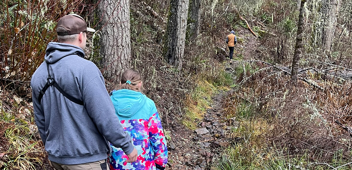
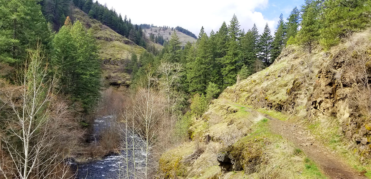
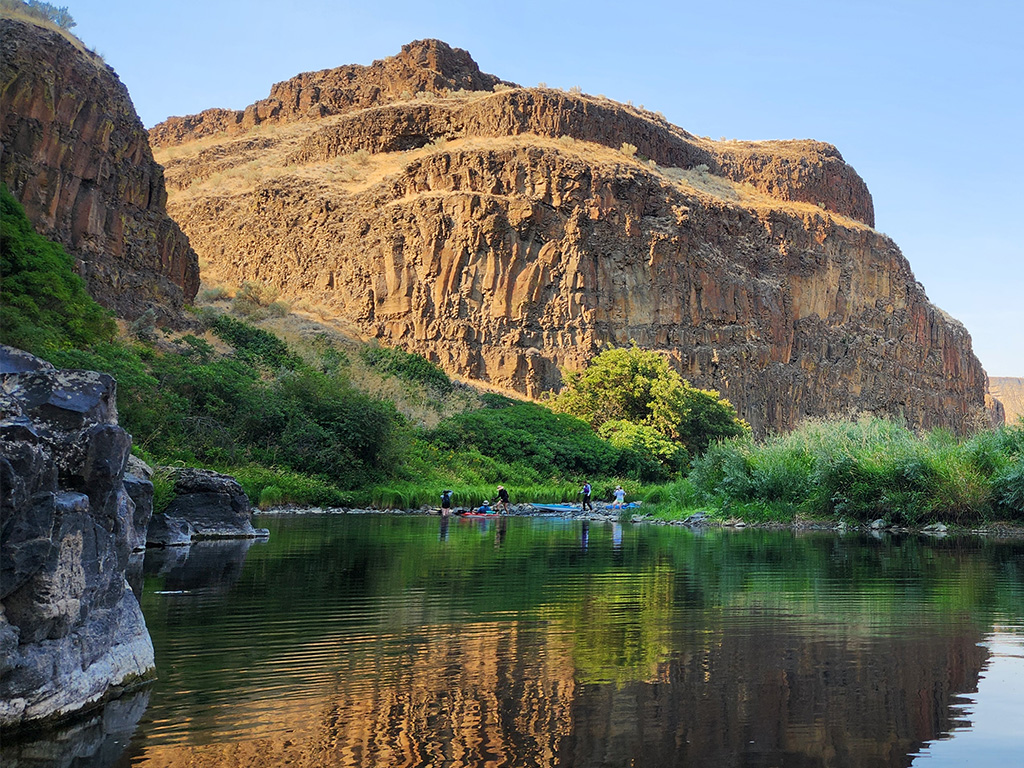
This beloved trail was once the favorite. In 2020, a massive flood washed out the road and sections of the trail. Visitors must walk to the trailhead, braving a questionable section at the intersection of a river bend and cliff wall. Public lands remain open, but use extreme caution. Though not maintained, the area is still breathtakingly beautiful.
Overview
- Distance:
- Within 1.5 Hours
- ADA:
- No
- Elevation:
- 2,115 - 5,000 feet
- Multi Use:
- Yes
- Seasons:
- Spring, Summer, Fall
- Pets:
- Yes
- Motorized Vehicles:
- No
- Fees:
- No
- Land Manager:
- Umatilla National Forest (Walla Walla Ranger District), Bureau of Land Management
- Permits:
- Valid Oregon fishing license (if fishing)--Not available at Harris Park for purchase. Fishing licenses are available online via the Oregon Department of Fish & Wildlife or you can purchase at Ranch & Home in Milton-Freewater, OR off HWY 11 on your way out of town.
- Amenities:
- There are vault toilets at both trailheads, although the lower facility remains closed. Back at Harris Park, there are picnic tables, campsites, additional toilets, playground and swings, sand volleyball court, and horseshoe pits.
- Distance:
- Within 1.5 Hours
- Seasons:
- Spring, Summer, Fall
- Elevation:
- 2,115 - 5,000 feet
- Pets:
- Yes
- Fees:
- No
- Land Manager:
- Umatilla National Forest (Walla Walla Ranger District), Bureau of Land Management
- ADA:
- No
- Multi Use:
- Yes
- Motorized Vehicles:
- No
- Permits:
- Valid Oregon fishing license (if fishing)--Not available at Harris Park for purchase. Fishing licenses are available online via the Oregon Department of Fish & Wildlife or you can purchase at Ranch & Home in Milton-Freewater, OR off HWY 11 on your way out of town.
WHAT TO DO
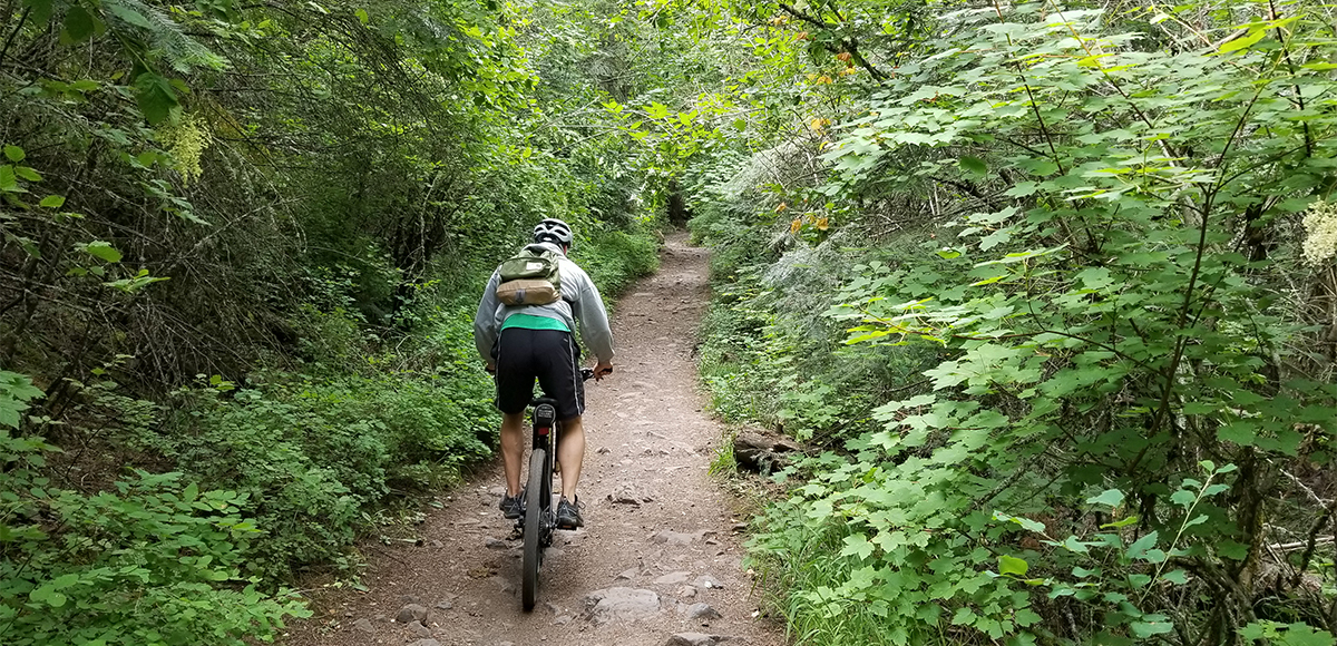
Hiking/ Biking
The South Fork Walla Walla Trail (#3225) is 19.6 miles one way. The upper trailhead is Deduct Trailhead on Forest Service Road 65, and the lower trailhead is near Harris Park. This trail also provides access to Table Springs/ Bear Creek Trail (#3223), Burnt Cabin Trail (#3226), the North Fork Walla Walla Trail (#3222) via Table Springs/ Bear Creek Trail (#3223), and Rough Fork Trail (#3227). Access from Deduct Trailhead is reliably available by summer.
Consult the Forest Service page for agency information.
Fishing
There are multiple opportunities just off the trail to set up for a day of fishing. Fishing regulations are highly specific and based on location and species. Please always consult the latest information available from the Oregon Department of Fish & Wildlife.
Camping
No camping is available at the trailhead, but Harris Park is less than a mile back down Walla Walla River Road. If backpacking, dispersed camping is available along the trail. Currently, camping is only allowed on Umatilla National Forest lands. The first few miles share various jurisdictions.
Consult the Forest Service page for agency information.
WHAT TO EXPECT
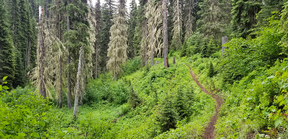
The views are still amazing along the trail, a definite departure from the rolling wheat fields surrounding town. It is a great place to bird, enjoy butterflies, put the camera to use, or just enjoy the scenery. If hiking, there are areas of steep ground and/or narrow trail. The trail is lost a few miles from the trailhead to a rock slide.
At this point, mountain biking, although allowed, is not recommended. According to the Forest Service, “the trail currently has washouts, debris slides, hazard trees, bridge damage, and ongoing repair work…Forest users are asked to travel on the trail at their own risk.”
Amenities
There are vault toilets at both trailheads, although the lower facility remains closed. Back at Harris Park, there are picnic tables, campsites, additional toilets, playground and swings, sand volleyball court, and horseshoe pits.
Regulations
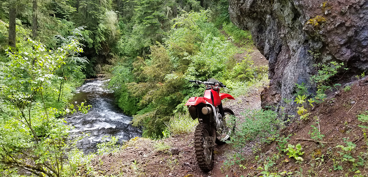
Motorized vehicles: Class 3 ATV (motorcycles) only. Must have current ORV registration and ATV safety card (motorcycles are a class III ATV). Safety cards are free online if over age 16 and those are good for life. Riders under 16 must take a hands on course. Full details at the Oregon Online ATV Safety Education Course website.
Wildlife Awareness
We are all so fortunate to recreate in the Blue Mountains and Walla Walla Valley. So many opportunities exist to play outside, whether in a national forest, wilderness area, or on a Wild and Scenic River. With these opportunities comes great responsibility to appreciate that we are mere visitors and should all take pride in being good stewards of the wild.
Many animals call these protected places home, including moose, elk, bear, cougar, bobcat, and snakes to name a few. Take precautions to respect their home and understand the appropriate response should an encounter occur.
Additionally, many plant species thrive in the Blue Mountains, so staying on trail is always good practice.
Carry First Aid supplies to better respond to accidents or encounters, and always let others know where the day’s adventure is taking you.
Field Notes
Navigation: Consider downloading the Avenza Map app. This app allows users to upload three maps (or unlimited with a subscription) to use offline. It can track your location offline and overlay GPS data from the phone onto the map. The vehicle use maps (for trails allowing motorized vehicles) are the easiest to use.
Otherwise, Geo Tracker offers similar tracking capabilities and additional details about your adventure. If no service, Geo Tracker will at least show your location. The Blue Mountains and surrounding area offer a remote recreating experience, and knowing your location is paramount to staying safe. Always make sure to bring paper maps. Tell others where your adventure is taking you and when you expect to return.
Pets: In general, pets are allowed on a leash and under control throughout jurisdictions. The only restrictions we have encountered are around swimming areas. As a best practice, be mindful of riparian habitat in general. You never know where a precious spawning area might be located. Pack it in and pack it out applies to your furry friend as well.
Disclaimer: While the Outside Walla Walla team has enjoyed all the adventures listed on this site, we cannot provide real-time conditions & maintenance reports. Extreme weather can change access overnight. Volunteer groups might lose capacity to manage trail systems. We do our best to report that information and update our site accordingly, but please read our Disclaimer (footer) and proceed with any adventure as your comfort level allows.
WHEN TO GO
The upper trailhead, Deduct Trailhead, is only an hour away, and access is reliably available by summer. The lower trailhead is still showing the impact of the 2020 flood. It is impossible to drive all the way to the lower trailhead. Visitors must park along the road and walk in, heeding warning signs about the condition of the area.
HOW TO GET THERE
There are multiple ways to access this trail. To keep it simple, we will focus on how to access the endpoints. To start at the top of the trail, go to Deduct Trailhead. Head east on Isaacs Avenue and continue onto Mill Creek Road. Travel on Mill Creek Road for 14 miles and you will come to a junction with Tiger Creek Road (sometimes referred to as Tiger Canyon Road or Tiger Ridge Road). Turn right onto Tiger Creek Road and cross a small bridge before the road begins its ascent.
If you miss your turn, you will come to the gate for the Mill Creek Watershed. Once on Tiger Creek Road, take it 10.5 miles and you will see a sign for the South Fork Walla Walla River Trailhead (which is really Deduct Trailhead for the South Fork Walla Walla Trail). Take the next right, and follow the road about 1/4 mile to its end.
The most popular way to access this trail is via the lower trailhead near Harris Park. There are a couple ways to get to Harris Park and the South Fork Walla Walla Trail. To avoid gravel and dirt roads, travel south on HWY 11 and go through Milton-Freewater, OR. Take a left on SE 15th Avenue (there is a sign for Harris Park). SE 15th Avenue becomes Walla Walla River Road and continues for roughly 14 miles. The road will take a right bend and become the South Fork Walla Walla River Road. Follow that road to the end, and the trail begins at the gate.
The second route takes you through wheat fields, so it is dusty and highly utilized by farming equipment. If this interests you, head south on Second Avenue in Walla Walla (go all the way to the end of Second Avenue) and take a right on Howard Street (the cemetery is on the right). You will pass Prospect Point Elementary and reach a four-way stop; keep straight and continue south (Howard Street becomes Cottonwood Road). You will come to another four-way stop at the intersection of Cottonwood Road and Langdon Road; continue straight heading south on to Powerline Road.
After two miles you will cross the Oregon State Line and Powerline Road becomes County 525 Road. County 525 Road will turn to gravel after about 1.5 miles. Continue for six miles, and you will return to pavement on Walla Walla River Road. Travel another 1/4 mile and turn left on South Fork Walla Walla River Road and the road ends at the trailhead.
If interested in the gravel road option, remember that large trucks and combines use those roads frequently. The road is especially dusty in dry conditions, which is most of the summer, and can make visibility quite low if following another vehicle. Don’t take a rental car on this road if you are from out of town. Consider utilizing both routes to take advantage of Milton-Freewater and its many points of interest as well as the unique and beautiful views showcased by the back road.
Please do not solely rely on Google Maps as their route might not always reflect what is maintained.
map
TRAILHEADS
LOWER TRAILHEAD
UPPER TRAILHEAD

DOWNLOAD GUIDE PDF
DOWNLOAD GUIDE PDF
ADDTIONAL INFORMATION
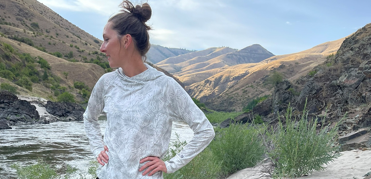
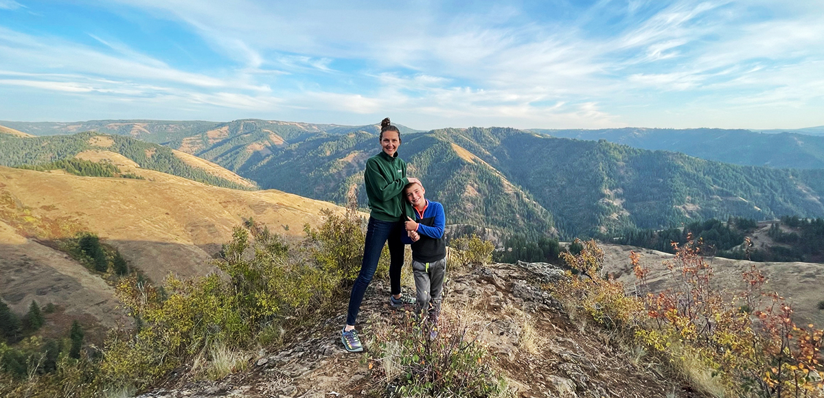
South Fork Walla Walla Trail Gallery
CHECKOUT MORE OF THE SITE

Activity
ACTIVITY
DISTANCE