CURRENT CONDITIONS
52° F
OUTSIDE WALLA WALLA
OUTSIDE WALLA WALLA
South Fork Umatilla River
With a slew of hiking trails and an abundance of water, the Umatilla Forks area makes for great camping. For those who prefer to camp a little more rugged, there are dispersed campsites alongside the river as you make your way past the Umatilla Forks Campground. Looking for a fishing hole or swimming hole? Your outdoor adventure awaits. There are also a handful of gorgeous trails that take users into the scenic North Fork Umatilla Wilderness area.
Overview
- Distance:
- Within 1.5 Hours
- ADA:
- No
- Elevation:
- 2,800 feet
- Multi Use:
- N/A
- Seasons:
- Spring, Summer, Fall
- Pets:
- Yes
- Motorized Vehicles:
- N/A
- Fees:
- None
- Land Manager:
- Umatilla National Forest (Walla Walla Ranger District)
- Permits:
- None permits are required to camp at dispersed sites. Fishing regulations are highly specific and based on location and species. Please always consult the latest information available from the Oregon Department of Fish & Wildlife.
- Amenities:
- Pack in and pack out. There is a vault toilet at the Umatilla Forks day-use area.
- Distance:
- Within 1.5 Hours
- Seasons:
- Spring, Summer, Fall
- Elevation:
- 2,800 feet
- Pets:
- Yes
- Fees:
- None
- Land Manager:
- Umatilla National Forest (Walla Walla Ranger District)
- ADA:
- No
- Multi Use:
- N/A
- Motorized Vehicles:
- N/A
- Permits:
- None permits are required to camp at dispersed sites. Fishing regulations are highly specific and based on location and species. Please always consult the latest information available from the Oregon Department of Fish & Wildlife.
WHAT TO DO
Hiking
This is a great part of the forest to access lower trailheads that lead into the North Fork Umatilla Wilderness area. Lick Creek Trail (#3070), Nine Mile Ridge Trail (#3072), and North Fork Umatilla River Trail (#3083) are all spectacular hikes within a few miles of any dispersed campsite.
Consult the Forest Service page for agency information.
Camping
There are several options for camping along the South Fork Umatilla River. Some spots are large enough for small RVs, but be aware that turnaround space is limited. We recommend not going further than two miles past the bridge as the road is narrow, rough, and not well maintained. There is limited space to turn around, so depending on the size of your vehicle it could be extremely challenging.
Consult the Forest Service page for agency information.
WHAT TO EXPECT
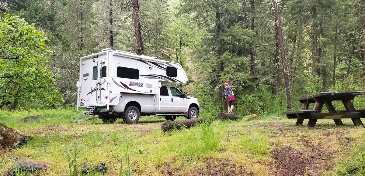
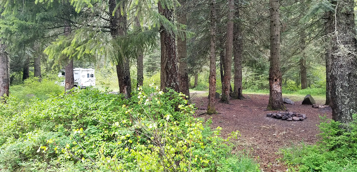
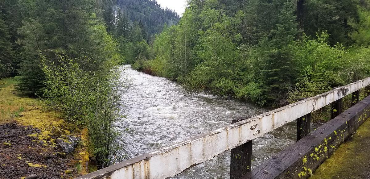
There are multiple spots to choose from within two miles of crossing the bridge. Dispersed camping is a lot like a choose your own adventure story. We have a few favorites based on access to the river. There are no amenities at dispersed camping spots. There are vault toilets at the Umatilla Forks Campground and North Fork Umatilla River Trail.
Be sure to follow the dispersed camping rules outlined under regulations and enjoy. Keeping these sites clean and minimizing impact on the environment is crucial, so practice leave no trace.
Amenities
Pack in and pack out. There is a vault toilet at the Umatilla Forks day-use area.
Regulations
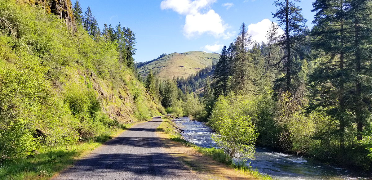
You may camp outside of developed campgrounds in most areas on the Umatilla National Forest up to 300 feet from an open road at no charge. Potable water, toilets, and other amenities are not generally available. If you choose to camp outside developed areas, be sure to bring adequate water or be prepared to purify any water source before drinking. Check out current burn restrictions prior to your trip as there is obviously not a camp host to relay that information.
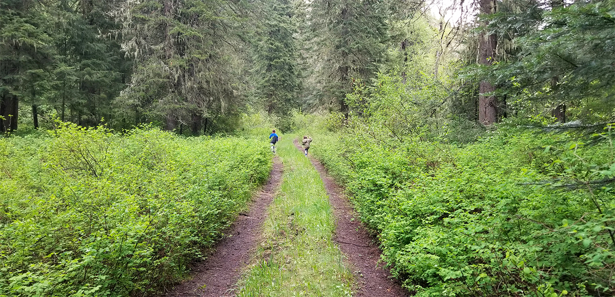
If you plan to hike one of the many nearby trails, please take note that wilderness regulations apply. The North Fork Umatilla Wilderness is literally across the river. Such restrictions include no motorized equipment, bicycles, or hang gliders to name a few. Groups larger than twelve are prohibited as well as caching or leaving equipment or supplies for longer than 72 hours. Most applicable to hikers is the fact that shortcutting a switchback on any trail is also a violation of wilderness regulations. For a complete list of wilderness regulations applicable to those within the forest, visit Umatilla National Forest website.
Wildlife Awareness
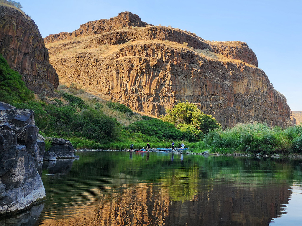
We are all so fortunate to recreate in the Blue Mountains and Walla Walla Valley. So many opportunities exist to play outside, whether in a national forest, wilderness area, or on a Wild and Scenic River. With these opportunities comes great responsibility to appreciate that we are mere visitors and should all take pride in being good stewards of the wild.
Many animals call these protected places home, including moose, elk, bear, cougar, bobcat, and snakes to name a few. Take precautions to respect their home and understand the appropriate response should an encounter occur.
Additionally, many plant species thrive in the Blue Mountains, so staying on trail is always good practice.
Carry First Aid supplies to better respond to accidents or encounters, and always let others know where the day’s adventure is taking you.
Field Notes
Navigation: Consider downloading the Avenza Map app. This app allows users to upload three maps (or unlimited with a subscription) to use offline. It can track your location offline and overlay GPS data from the phone onto the map. The vehicle use maps (for trails allowing motorized vehicles) are the easiest to use.
Otherwise, Geo Tracker offers similar tracking capabilities and additional details about your adventure. If no service, Geo Tracker will at least show your location. The Blue Mountains and surrounding area offer a remote recreating experience, and knowing your location is paramount to staying safe. Always make sure to bring paper maps. Tell others where your adventure is taking you and when you expect to return.
Pets: In general, pets are allowed on a leash and under control throughout jurisdictions. The only restrictions we have encountered are around swimming areas. As a best practice, be mindful of riparian habitat in general. You never know where a precious spawning area might be located. Pack it in and pack it out applies to your furry friend as well.
Disclaimer: While the Outside Walla Walla team has enjoyed all the adventures listed on this site, we cannot provide real-time conditions & maintenance reports. Extreme weather can change access overnight. Volunteer groups might lose capacity to manage trail systems. We do our best to report that information and update our site accordingly, but please read our Disclaimer (footer) and proceed with any adventure as your comfort level allows.
WHEN TO GO
Late spring after the initial snow melt is a great time to start recreating in this part of the world. Call the Umatilla National Forest (Walla Walla Ranger District) before going to check on road conditions.
When the river is high or at flood stage, the road does close for obvious safety reasons. We frequent this area as the lower trailheads provide more hiking under shade. Camping is also quite fun as spots are tucked near the river and, again, under the canopy of dense riparian habitat.
HOW TO GET THERE
An important note about how to reach this area—the bridge on Spring Hollow Road is impassible. Some apps will direct you to take Pambrun Road. This will lead to a ten mile backtrack to the highway. Currently, Google Maps is reflecting the correct route via Mann Road. The passable route does involve gravel roads. These roads are typically well maintained, but expect some water running over the road depending on the weather, potholes, and mud.
From Walla Walla, take HWY 11 south just past Athena, Oregon. Turn left on Mann Road and continue for 1 mile to its intersection with Crawford Hollow Road (these two roads make a Y, the paved road transitions from Mann Road to Crawford Road). Keep right and stay on Mann Road (now gravel) at the Y & continue for 4 miles. Turn left on North Cayuse Road and continue to the end of the road. Make a left turn returning to pavement on Cayuse Road & continue for 5 miles. Make a right turn onto Bingham Road/ County Road 900 (becomes Forest Service Road 32 at the forest boundary).
Follow Bingham Road/ County Road 900 for approximately 9.5 miles going just past the Umatilla Forks Campground and make a right turn crossing the bridge over the North Fork Umatilla River. Once over the bridge there will be dispersed sites on the river side of the road. We recommend not going further than two miles past the bridge as the road is narrow, rough, and not well maintained. There is limited space to turn around, so depending on the size of your vehicle it could be extremely challenging.
Please do not solely rely on Google Maps as their route might not always reflect what is maintained.
map
TRAILHEADS
LOWER TRAILHEAD
UPPER TRAILHEAD
DOWNLOAD GUIDE PDF
DOWNLOAD GUIDE PDF
ADDTIONAL INFORMATION
South Fork Umatilla River Gallery
CHECKOUT MORE OF THE SITE
Activity
ACTIVITY
DISTANCE


